.
NORTH CAROLINA WATERFALLS
RAINBOW FALLS (4)
PHOTO BY CHRISTIE W.
Driving Directions: From the intersection of U.S. 276, U.S. 64, and N.C. 280 in Brevard, drive 5.1 miles north on U.S. 276 to F.R. 475 on the left at the sign for the Pisgah Center for Wildlife Education. Turn left onto F.R. 475, passing the Pisgah Center for Wildlife Education in 1.3 miles and F.R. 475B on the right in 1.5 miles. Continue on F.R. 475, which changes to gravel, for 4.2 miles to the gated F.R. 5095 on the left.
Hiking Directions: Begin the hike past the gate on F.R. 5095 for 0.83 mile to the first creek crossing. The creek flows under the road using a large culvert. Before the creek crossing, a short scramble path leads to the base of the upper portion of the falls.
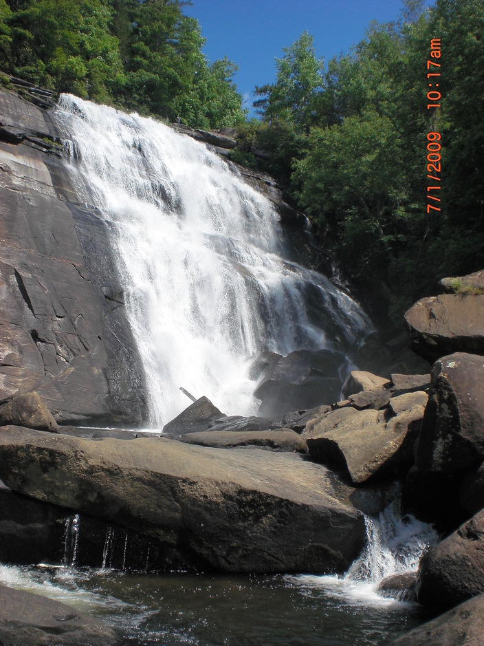
PHOTO BY CHRISTIE W.
Driving Directions: From the intersection of N.C. 281 north and U.S. 64 west, turn left onto N.C. 281 north and drive 2.5 miles to N.C. 281 south. Turn left onto N.C. 281 south and drive 0.9 mile to the entrance to Gorges State Park on the left. Follow the paved road past the Visitor’s Center to the Frozen Creek Access Area, the first parking area, on the right.
Hiking Directions: The blue blazed Raymond Fisher trail and the orange blazed Rainbow Falls trail begins here. Follow the trail for 0.28 mile to where the Raymond Fisher trail turn lefts and the Rainbow Falls trail turns right. Turn right and hike 0.71 mile to a small stream crossing. In another 0.11 mile, reach a sign that indicates that you are leaving Gorges State Park and entering the Pisgah National Forest. At 0.99 mile from the trailhead, a brown carsonite steak marks the side trail on the left for Stairway Falls. In another 0.11 mile, come to a creek crossing. Cross the creek and hike another 0.45 mile to Rainbow Falls on the left.